 |
|
|
Background
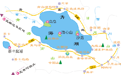
Map
|
Qinghai Lake is the largest endorheic lake
and salt-water lake in China. Its voluminous
and misty scenery likes a tear on the surface
of the earth.Located on the Qinghai-Tibet
Plateau, Qinghai Lake has a acreage of 4538sq.km
and perimeter of 360km, which is more than
two time of the famous Tai Lake. The average
depth of Qinghai Lake is about 16m, with
the deepest point to 28m. The poundage reaches
71.9 billion stere. The altitude of Lake
Surface is 3195m, which approximates to
two height of Mount Tai. The weather is
very cool here due to the high altitude.
Even in midsummer, the average temperature
is just 15 degree centigrade. It's a perfect
resort for passing the summer in a leisurely
way.
Qinghai Lake is on the northeast of Qinghai-Tibet
Plateau. The lake is surrounded by four
lofty mountains, with Datong Mountain on
its north, Riyue Mountain on its east, Qinghainan
Mountain on the south and Xiangpi Mountain
on the west. The altitude of these four
mountains is from 3600km to 5000km. These
four mountains like four barriers carrying
Qinghai Lake in their arms. From the root
of mountain to the Lake, there is vast and
flat grassland. The green and wavy lake
is similar to a grand jade lying between
mountains and grassland.
|
|
|
|
